Blog search

Friday 29 September 2017

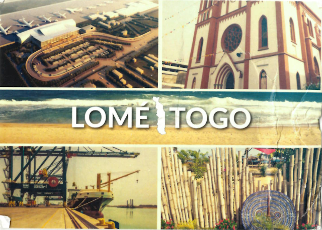
Postcard from Togo (Открытка из Того)

View Postcard from Togo

Stamps from Togo


Incoming postcard from -  Togo!

        officially the Togolese Republic is a country in West Africa bordered by Ghana to the west, Benin to the east and Burkina Faso to the north. It extends south to the Gulf of Guinea, where its capital Lomé is located. Togo covers 57,000 square kilometres (22,008 square miles), making it one of the smallest countries in Africa, with a population of approximately 7.6 million.

Thank you Taowyik!

Postcard from Tahiti (French Polynesia) (Открытка из Таити)

Postcard from Tahiti (French Polynesia)

Stamps from Tahiti (French Polynesia)

Wonderful postcard incoming from - Tahiti (French Polynesia)!

       Tahiti (previously also known as Otaheite (obsolete) is the largest island in the Windward group of French Polynesia; this overseas collectivity of the French Republic is sometimes referred to as a French overseas country It is located 4,400 kilometres south of Hawaii, 7,900 km from Chile and 5,700 km from Australia.The island is located in the archipelago of the Society Islands in the central Southern Pacific Ocean, and is divided into two parts: the bigger, northwestern part Tahiti Nui and the smaller, southeastern part Tahiti Iti. The island was formed from volcanic activity and is high and mountainous with surrounding coral reefs. The population is 183,645 inhabitants (2012 census), making it the most populous island of French Polynesia and accounting for 68.5 percent of its total population.
       Tahiti is the economic, cultural and political centre of French Polynesia. The capital, Papeete, is located on the northwest coast with the only international airport in the region, Fa'a'ā International Airport, situated 5 km from the town centre.
Tahiti was originally settled by Polynesians between 300 and 800 CE. They represent about 70 percent of the island's population with the rest made up of Europeans, Chinese and those of mixed heritage.
       The island was part of the Kingdom of Tahiti until its annexation by France in 1880, when it was proclaimed a colony of France, and the inhabitants became French citizens. French is the only official language, although the Tahitian language (Reo Tahiti) is widely spoken.
 
I am very grateful to sender!

Postcard from Northern Mariana Islands (Открытка из Северных Марианских островов)

Postcard from Saipan

Stamps from Northern Mariana Islands

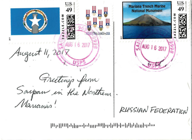
Paradise postcard incoming from - Northern Mariana Islands!

       The Northern Mariana Islands, officially the Commonwealth of the Northern Mariana Islands (CNMI; Chamorro: Sankattan Siha Na Islas Mariånas; Refaluwasch or Carolinian: Commonwealth Téél Falúw kka Efáng llól Marianas), is an insular area and commonwealth of the United States consisting of 15 islands in the northwestern Pacific Ocean. The CNMI includes all islands in the Mariana Archipelago except Guam which is the southernmost island of the chain and a separate U.S. territory.
       The administrative center is Capitol Hill, a village in northwestern Saipan. However, most publications consider Saipan to be the capital because the island is governed as a single municipality.
       According to the 2010 census, the population of the CNMI as of April 1, 2010, was 53,883, down from 69,221 in 2000, a decrease of 22.2%.
       The Northern Mariana Islands, together with Guam to the south, compose the Mariana Islands archipelago. The southern islands are limestone, with level terraces and fringing coral reefs. The northern islands are volcanic, with active volcanoes on several islands, including Anatahan, Pagan, and Agrihan. The volcano on Agrihan has the highest elevation at 965 m.

I am very grateful to Arnold!
Postcard from Saint Lucia (Открытка из Сент-Люсии)

View Postcard from Saint Lucia

Stamps from Saint Lucia

Very beautiful postcard Incoming from  Saint Lucia!
 
       is a sovereign island country in the eastern Caribbean Sea on the boundary with the Atlantic Ocean. Part of the Lesser Antilles, it is located north/northeast of the island of Saint Vincent, northwest of Barbados and south of Martinique. It covers a land area of 617 km2  and reported a population of 165,595 in the 2010 census.
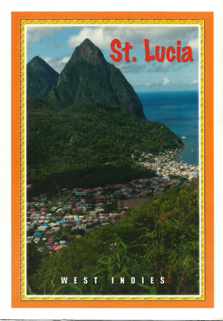
       The volcanic island of Saint Lucia is more mountainous than most Caribbean islands, with the highest point being Mount Gimie, at 950 metres above sea level. Two other mountains, the Pitons, form the island's most famous landmark. They are located between Soufrière and Choiseul on the western side of the island. Saint Lucia is also one of the few islands in the world that boasts a drive-in volcano.
       The capital city of Saint Lucia is Castries (population 60,263) where 32.4% of the population lives. Major towns include Gros Islet, Soufrière, and Vieux Fort.
       The local climate is tropical, moderated by northeast trade winds, with a dry season from 1 December to 31 May, and a wet season from 1 June to 30 November.
       Saint Lucia reported a population of 165,595 in the 2010 national census. In 2016, the United Nations Population Division estimated Saint Lucia's population at 178,015. The country's population is evenly divided between urban and rural areas, with more than a third living in the capital, Castries.
On this postcard you may see The Pitons, twin peaks of St.Lucia, Gros and Petit Pitons. The Gros Piton can be climbed right up to the top.
Thank you so much for such deauty dear Mary!


Postcard from Myanmar (Открытка из Мьянмы (Бирмы))

View Postcard from Myanmar

Stamps from Myanmar Burma

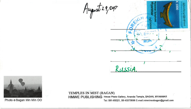
Magnificent and romantic Incoming from - Myanmar!
 
       officially the Republic of the Union of Myanmar and also known as Burma, is a sovereign state located in the Southeast Asian region. Myanmar is bordered by India and Bangladesh to its west, Thailand and Laos to its east and China to its north and northeast. To its south, about one third of Myanmar's total perimeter of 5,876 km  forms an uninterrupted coastline of 1,930 km along the Bay of Bengal and the Andaman Sea. The country's 2014 census counted the population to be 51 million people. Myanmar is 676,578 square kilometers in size. Its capital city is Naypyidaw, and its largest city and former capital is Yangon (Rangoon).
       Myanmar is a country rich in jade and gems, oil, natural gas and other mineral resources.
       The provisional results of the 2014 Myanmar Census show that the total population is 51,419,420.

I am very grateful to Jeremiah!
 

Postcard from Malawi (Открытка из Малави)

flag Postcard from Malawi

Stamps from Malawi

One more Incoming from  Malawi!

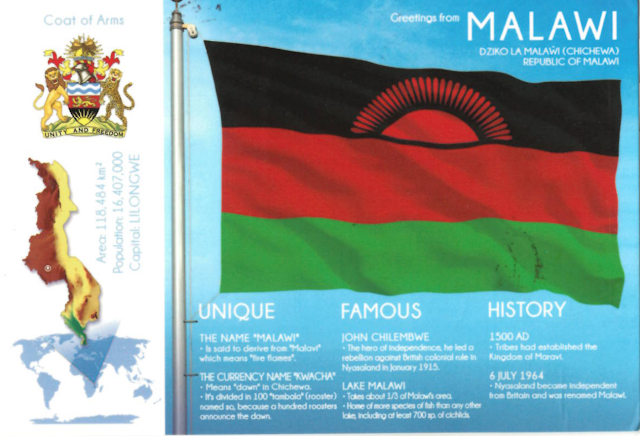
This postcard is from colletion "Flags of the world" or shortly "FOTW" from site postcardmarket.

I am very grateful to Mike!
 

Postcard from Cambodia (Открытка из Камбоджи)

View Postcard from Cambodia

Stamps from Cambodia


Very a beautiful postcard from- Cambodia!

       Cambodia officially known as the Kingdom of Cambodia is a country located in the southern portion of the Indochina Peninsula in Southeast Asia. It is 181,035 square kilometres in area, bordered by Thailand to the northwest, Laos to the northeast, Vietnam to the east, and the Gulf of Thailand to the southwest.
       Cambodia has a population of over 15 million. The official religion is Theravada Buddhism, practiced by approximately 95 percent of the population. The country's minority groups include Vietnamese, Chinese, Chams, and 30 hill tribes.The capital and largest city is Phnom Penh, the political, economic, and cultural centre of Cambodia. The kingdom is a constitutional monarchy with Norodom Sihamoni, a monarch chosen by the Royal Throne Council, as head of state. The head of government is Hun Sen, who is currently the longest serving non-royal leader in South East Asia and has ruled Cambodia for over 30 years.
 
Thank you so much for help dear Jeremiah!

Postcard from Cabo Verde (Открытка из Кабо-Верде)

 
View Postcard from Cabo Verde

Stamps from Cabo Verde Cape Verde

Amazing paradise incoming from -  Cabo Verde!

       Cape Verde or Cabo Verde officially the Republic of Cabo Verde, is an island country spanning an archipelago of 10 volcanic islands in the central Atlantic Ocean. Located 570 kilometres west of the Cape Verde Peninsula in West Africa, near Senegal, The Gambia, and Mauritania, and is part of the Macaronesia ecoregion, the islands cover a combined area of slightly over 4,000 square kilometres.
       The Cape Verde archipelago was uninhabited until the 15th century, when Portuguese explorers discovered and colonized the islands, establishing the first European settlement in the tropics. Ideally located for the Atlantic slave trade, the islands grew prosperous throughout the 16th and 17th centuries, attracting merchants, privateers, and pirates. The end of slavery in the 19th century led to economic decline and emigration. Cape Verde gradually recovered as an important commercial center and stopover for shipping routes. Incorporated as an overseas department of Portugal in 1951, the islands continued to agitate for independence, which was peacefully achieved in 1975.
       Cape Verde is a member of the African Union.
       The official Census recorded that Cape Verde had a population of 512,096 in 2013. A large proportion (236,000) of Cape Verdeans live on the main island, Santiago.

Thank you very much dear Juraj!
 

Wednesday 27 September 2017

Postcard from Iraq (Открытка из Ирака)

Incoming view Postcard from Iraq

Stamps from Iraq

Wonderful incoming from -  Iraq!

       officially known as the Republic of Iraq (Arabic: جمهورية العراق‎‎ Jumhūrīyyat al-‘Irāq; Kurdish: کۆماری عێراقKomari Eraq) is a country in Western Asia, bordered by Turkey to the north, Iran to the east, Kuwait to the southeast, Saudi Arabia to the south, Jordan to the southwest, and Syria to the west. The capital, and largest city, is Baghdad. The main ethnic groups are Arabs and Kurds; others include Assyrians, Turkmen, Shabakis, Yazidis, Armenians, Mandeans, Circassians, and Kawliya.Around 95% of the country's 37 million citizens are Muslims, with Christianity, Yarsan, Yezidism, and Mandeanism also present. The official languages of Iraq are Arabic and Kurdish.
       Iraq has a coastline measuring 58 km (36 miles) on the northern Persian Gulf and encompasses the Mesopotamian Alluvial Plain, the northwestern end of the Zagros mountain range, and the eastern part of the Syrian Desert.Two major rivers, the Tigris and Euphrates, run south through Iraq and into the Shatt al-Arab near the Persian Gulf. These rivers provide Iraq with significant amounts of fertile land.
       The 2016 estimate of the total Iraqi population is 37,202,572.
 
On this postcard you see an old store in distict "Tannoma" of city Basrah in the south of Iraq. Basrah contributes 90 % of iraqi economy made by oil production and export.
 
Very grateful to Hasanain!
 

Postcard from Bora Bora (French Polynesia) (Открытка из Бора-Бора)

Postcard from Bora Bora (French Polynesia)

Stamps from Bora Bora (French Polynesia)

Wonderful postcard incoming from -  Bora Bora!
 
       Bora Bora is a 30.55 km2 island group in the Leeward group in the western part of the Society Islands of French Polynesia, an overseas collectivity of France in the Pacific Ocean. The main island, located about 230 kilometres northwest of Papeete, is surrounded by a lagoon and a barrier reef. In the center of the island are the remnants of an extinct volcano rising to two peaks, Mount Pahia and Mount Otemanu, the highest point at 727 metres.
       Bora Bora is a major international tourist destination, famous for its aqua-centric luxury resorts. The major settlement, Vaitape, is on the western side of the main island, opposite the main channel into the lagoon. Produce of the island is mostly limited to what can be obtained from the sea and the plentiful coconut trees, which were historically of economic importance for copra.
       The Bora Bora group has a permanent population of 9690.
 
On this postcard and stamp you may see Miss Tahiti 2016 -  Vaea Ferrand.
 
Thank you very much dear sender!